Burrow Surveyor
Animal burrows dug by badgers and beavers pose an increasing and serious risk to vital Dutch infrastructure. Due to growing populations, more and more underground tunnel systems are appearing, which undermine the stability of railways, dikes, and roads. Since these tunnels are often invisible from the surface, there is a risk of subsidence and damage without it being immediately noticed. Early detection and mapping of these burrows is therefore crucial to ensure the safety and continuity of infrastructure.
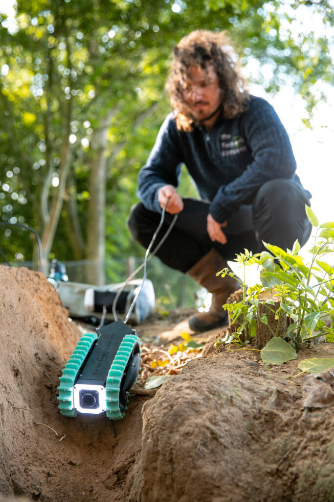
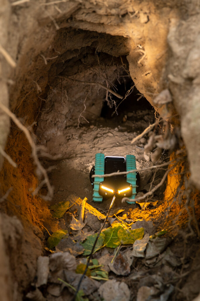
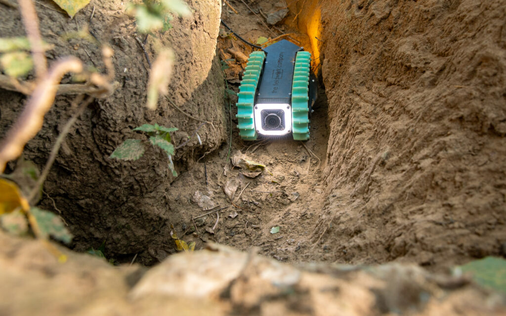
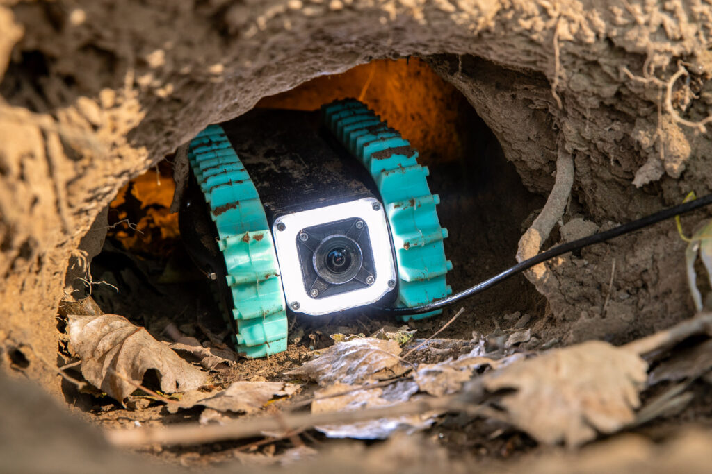
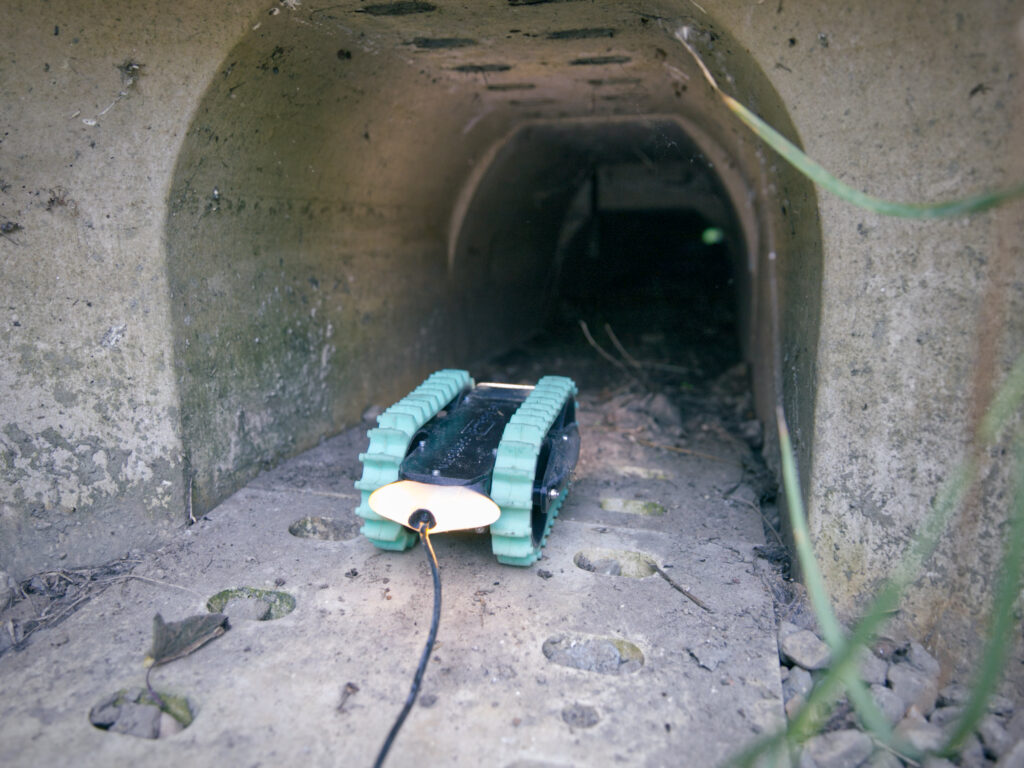
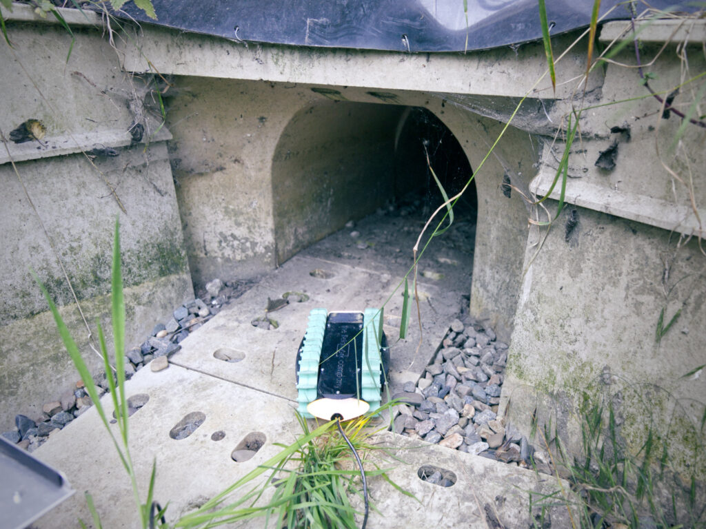
The Burrow Surveyor is a compact and advanced sensor platform that maps these underground tunnels and hollow spaces quickly and non-destructively. Using video footage, sensor data, and 3D models, it provides insights for risk analyses and helps managers take appropriate measures. Thanks to its robust design, the Burrow Surveyor is highly versatile—usable for everything from animal burrows to wildlife tunnels and civil engineering structures.
Share this project
The Burrow Surveyor is an advanced and compact sensor platform that visualizes underground tunnels and hollow spaces. Thanks to its state-of-the-art camera and sensors, the system collects crucial data about the subsurface situation in a practical and non-destructive way.
This data forms a solid foundation for risk analyses related to the stability of the soil structure. It immediately shows whether intervention is needed and which measures are most appropriate.
The Burrow Surveyor is continuously being developed. Each new deployment provides valuable insights, which we use right away to further improve the technology. Under the working title RobotMol, we have already carried out several inspections, such as:
Inspection badger sett next to flood barrier (Commissioned by STOWA/Waterschap Aa en Maas)
Inspection badger sett in railway embankment (Commissioned by ProRail)
Underground Inspections
Although the Burrow Surveyor was originally developed for mapping animal burrows, the inspection robot is also highly suitable for other types of underground inspections. Consider, for example:
- Wildlife passages and tunnels, where insight into accessibility and contamination is essential
- Measuring and inspecting erosion or washout around civil engineering structures, for volume and risk assessment
- Other hard-to-reach underground spaces where visual inspections or measurements are required
Thanks to its robust design and compact dimensions, the Burrow Surveyor can be flexibly deployed in a wide range of situations. Contact us to learn more about the possibilities for your application.
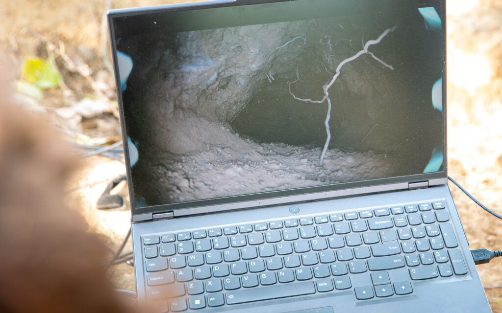
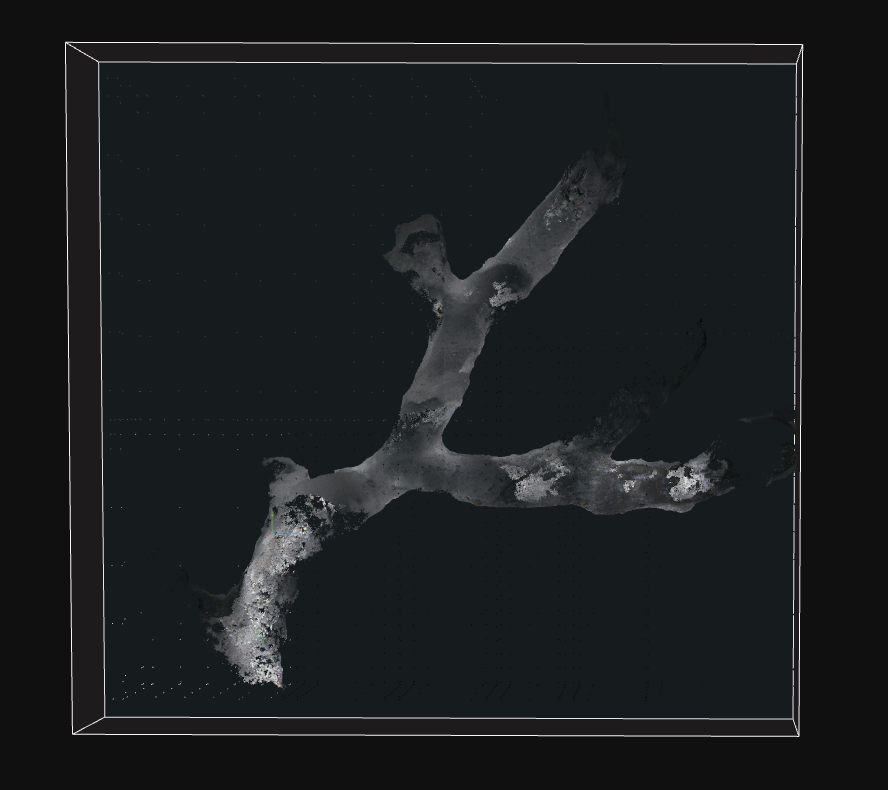
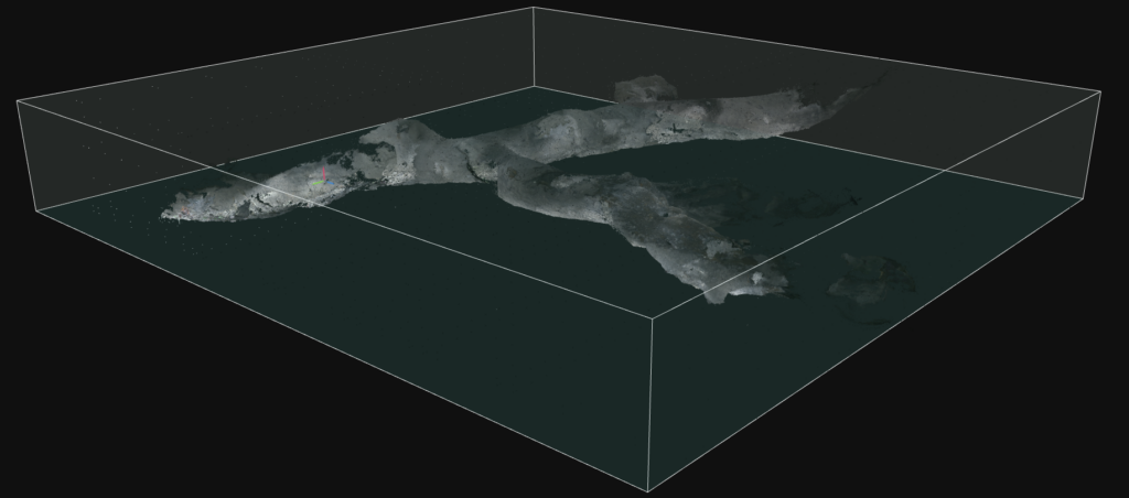
The video above provides an impression of an inspection and what the final 3D model looks like.
Output
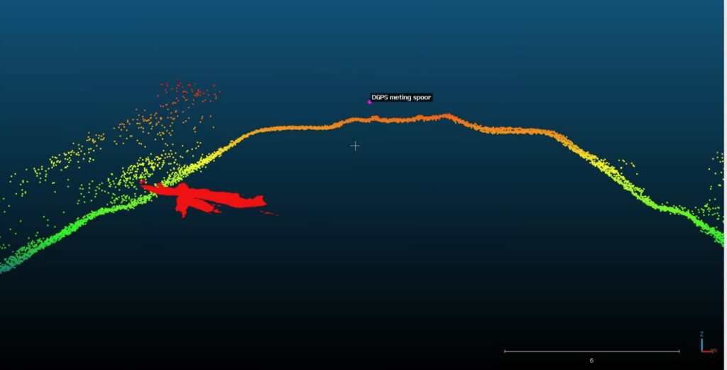
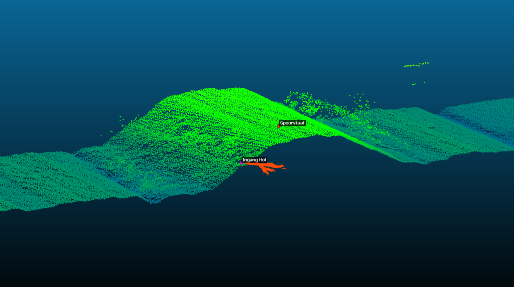
In many cases, a visual inspection with photo and video recordings is sufficient. But when needed, we take it a step further: we generate a detailed 3D model of the surveyed area. This model can be combined with the Dutch Elevation Dataset (AHN), making the location and size of underground spaces immediately visible in relation to their surroundings.
This integrated data enables clients to perform calculations, for example:
How close is a badger burrow to a railtrack?
What is the volume of washout near a civil engineering structure?
Specifications
- Suitable for tunnels/spaces with a diameter of 20 cm or larger
- Dimensions: 28 x 17 x 12 cm (L x W x H)
- Operates at depths of up to 9 meters
- Portable power supply for inspections at various locations
Client
n.v.t.
Involved part(ies)

ProRail